Pathanamthitta · Kerala
Modern Land Surveying & Engineering Solutions
Accurate digital survey services, at your fingertips.
Static Survey Solutions — a collaborative initiative of experienced engineers and professional land surveyors.
N 9°15′53″ E 76°47′13″ — Pathanamthitta
Why choose us
Trusted for precision
across Kerala
From boundary disputes to large infrastructure projects, we deliver accurate, properly documented solutions — on time, every time.
State-of-the-art technology
Precise measurements using Total Station, GPS (RTK), and drone — giving you verified, dispute-proof results that hold up everywhere.
Experienced team
Qualified surveyors and civil engineers working together, so we handle the full picture from measurement to layout to cost estimation.
On-time delivery
Accurate maps and reports within the promised timeframe, at a price agreed upfront. No surprises, no hidden charges.
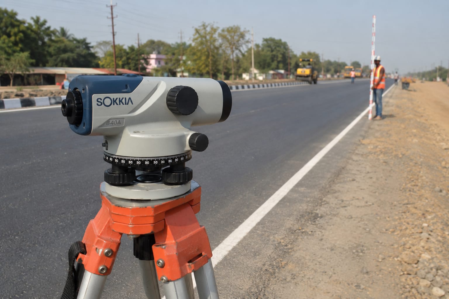
In the field
Precision work,
delivered on site.
From urban plots to remote hillside terrain, we bring the instruments to you and deliver results you can rely on — clear sketches, accurate measurements, documentation that holds up.
What we do
Land survey & engineering
services across Kerala
For landowners, builders, contractors, and developers — from simple boundary surveys to large civil-infrastructure projects.
Area & Boundary Survey
Precisely mark property limits, resolve disputes, and confirm the exact extent and position of your plot.
Contouring & Topographic Mapping
Record elevation and terrain features — essential for construction planning, drainage design, and site development.
Road Levelling & Alignment
Precise levelling for road construction and upgrades — slope, curves, and drainage designed correctly from the start.
Quantity Surveying & Earthwork
Calculate exact volumes and cut-and-fill requirements so project costs can be estimated accurately in advance.
Traverse Survey
High-precision control-network surveys of large tracts of land, roads, and alignments — eliminating accumulated errors.
Setting Out / Layout Survey
Mark buildings, roads, and columns on the ground from the engineering plan — so construction can begin accurately.
GPS / GNSS Survey
Satellite-based RTK positioning for fast, highly accurate measurements over wide areas with geo-referenced data output.
Drone Mapping
Aerial surveys for rapid, detailed mapping of large sites and difficult terrain — orthophotos and 3D models delivered.
Digital Mapping & CAD Drafting
AutoCAD 2D/3D digital plans of surveyed sites — submission-ready drawings for approvals and project use.
Service area
Based in Pathanamthitta.
Serving all of Kerala.
We travel across all 14 districts for survey and engineering work. Not sure if we cover your area? Just call — we likely do.
- Pathanamthitta
- Thiruvananthapuram
- Kollam
- Alappuzha
- Kottayam
- Idukki
- Ernakulam
- Thrissur
- Palakkad
- Malappuram
- Kozhikode
- Wayanad
- Kannur
- Kasaragod
Free consultation · No obligation